
Oxford Greenways: a cure for congestion?
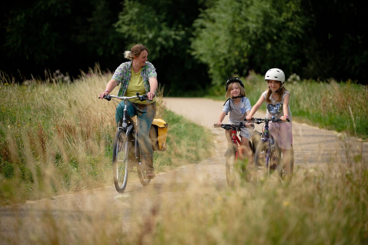
How far would you be prepared to cycle to work? Research suggests that, for most people, 2 to 5 miles is the sweet spot – or a little further on an e-bike.
That's 10 to 30 minutes each way. Enough for health benefits, but not too tiring. Enough to be competitive with car or bus when you factor in parking or walking to the bus stop. Enough to not take a chunk out of your day.
And, crucially, enough to get you out of the city centre house price bubble. Thousands of homes are planned within this radius of Oxford: in Kidlington, Eynsham, Grenoble Road, Berinsfield, Abingdon and more.
None of these, perhaps with the exception of Abingdon, have a cycle route to Oxford good enough for daily commuting. At best they're uncomfortable; at worst, actively lethal. The upshot is that new residents will choose to drive to work on roads which are congested already.
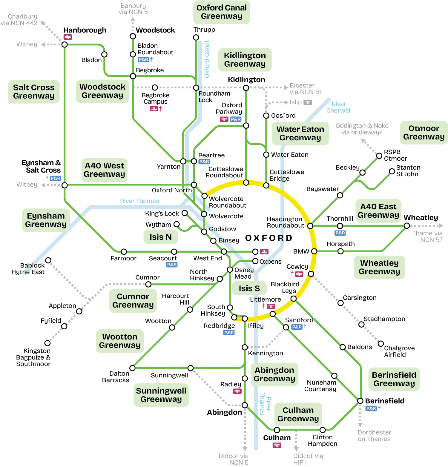
This week, Oxford's councils and university announced a programme to fix this. The ‘Greenways’ are intended to make cycle commuting practical from towns and villages around the city. 18 routes have been lined up, from Woodstock and Kidlington in the north, to Berinsfield and Abingdon in the south.
But will these really be safe enough to attract first-time cycle commuters – and will they ever be built? Let’s take a closer look.
The network
The ‘green’ branding belies how built-up this hinterland already is. Right now, the population of Oxford itself is 166,000: the city within the ring road, plus suburbs like Littlemore, the Leys, and Cutteslowe.
The proposed Greenways fan out into an area with a total of 271,000 residents. At today’s figures, then, they would enable another 105,000 people to safely cycle to Oxford for work, education, or leisure.
But Oxfordshire is changing. With few opportunities left to build within the ring road, this hinterland is earmarked for massive development over the next 20 years. That’s both residential – with thousands of new homes planned in locations like Begbroke, Berinsfield and Dalton Barracks (near Wootton) – and commercial, with research-focused businesses at Culham, Begbroke again, and around the southern edge of Oxford. By 2040, local politicians envisage another 105,000 residents.
The Greenways, then, could ultimately link 210,000 people to jobs and facilities in Oxford – more than the population of the city itself. Maps published by Oxfordshire County Council today suggest the routes have been deliberately chosen to link many of the new developments; one route alone, the Woodstock Greenway, connects nine sites.
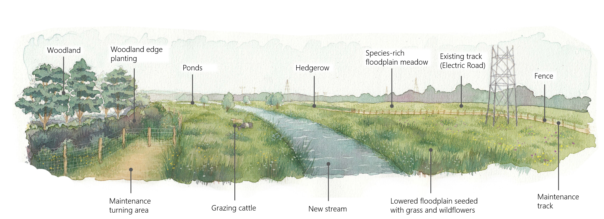
Most of the routes are radial, extending out from Oxford’s ring road, but an interesting pair of Greenways is proposed for the west of the city itself. The western half of the ring road, from Wolvercote to Hinksey Hill, has either no cycle track or a narrow, substandard one. Yet West Oxford is set to become the biggest development site within the city itself, with new building at Osney Mead, Oxpens, and along the Botley Road. The Isis North and Isis South greenways would run along the Thames (or Isis) floodplain, capitalising on the flood relief channel soon to start construction – providing a direct route to both the West End and Oxford North, while avoiding narrow paths like the Thames Path and canal towpath.
The university
Councils publishing ambitious transport plans is nothing new, but the involvement of the University of Oxford is. At a public launch for the project yesterday, Pro-Vice Chancellor Mark E Smith explained that the university saw the Greenways as a crucial part of remaining competitive with other institutions.
Although Oxford remains number one in Times Higher Education’s worldwide rankings, published this week, its lead is narrowing. Both the university and its colleges are increasingly building facilities outside the city (notably around Begbroke), while the spin-outs that give the research sector its economic vitality cluster in Culham and around south Oxford.
Congested roads in themselves decrease these spin-outs’ competitiveness. More than that, ‘quality of life’ is increasingly vital in attracting researchers within a global marketplace. It’s no coincidence that the other city in Britain with a Greenways programme is Cambridge.
The design
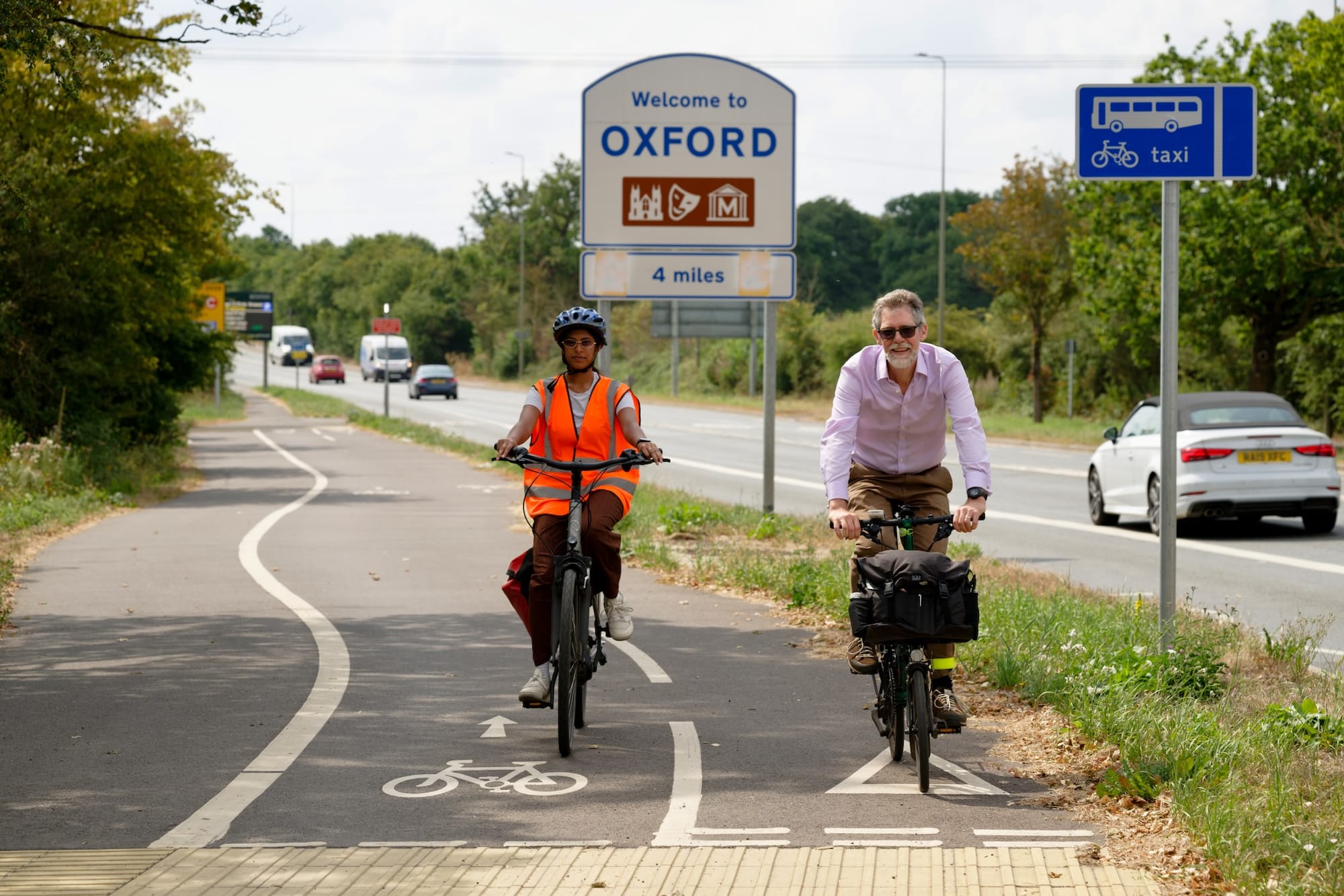
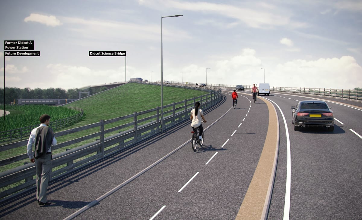
Across all 18 Greenways, the common factor is that the routes will be almost entirely car-free. New (or upgraded) cycle tracks beside roads, resurfaced bridleways, and paths across new developments make up the great majority of the network. Only in a few quieter, more remote locations will cyclists be asked to share the road with cars.
This marks a step change from Oxford’s previous cycling strategy, where experienced cyclists were expected to share space with heavy traffic on main roads, while beginners were relegated to indirect back-street routes. If that ever worked in Oxford (and opinion is divided), it’s not practical beyond the ring road, where cars regularly travel at 60mph and blind bends lead to dangerous overtakes.
Many of the Greenway routes will require brand new cycle track construction – beside the B4044 to Eynsham, the A4074 to Berinsfield, and Lower Road from Salt Cross to Hanborough. New roadside cycleways don’t come cheap.
But other routes simply involve surfacing existing rights of way, or upgrading older paths. The existing path beside the A40 to Wheatley, for example, is barely a metre wide in places and gives way to the smallest side-roads. Bringing this up to modern standards need not be expensive.
In some places, the job is to connect up existing (or proposed) cycleways. The £332m HIF1 road scheme, now under construction, will include cycle tracks along its full length. But without connections to existing routes, they are unlikely to attract many users. The Culham Greenway would extend this to Berinsfield and Abingdon, linking two population centres with the research campus at Culham.
The reality?
Seasoned transport watchers will know this isn’t the first attempt to set out ambitious cycling goals for Oxfordshire.
It is, however, by far the most detailed – and that could make the difference. Developers are required to fund infrastructure improvements through regulations with obscure names like Section 106, Section 278 and Community Infrastructure Levy. Without detailed plans to work from, cycling infrastructure is often ignored. By setting out the work required to deliver the Greenways, councils have a fighting chance of requiring developers to fund them.
The need is pressing. Crane lights are already blinking in the night sky at Oxford North and Oxford Science Park as construction gathers pace. For several projects, infrastructure cash is already spoken for. If a Greenways plan had been set out five years ago, miles of route could already be under construction – but then, the second best time to plant a tree is now.
Relying on developers to build cycle routes is perilous. We reported earlier today on new housing in Sandford-on-Thames, easy cycling distance from Oxford, where commuters would have to wait at four sets of traffic lights, dismount on a narrow section of pavement, and cross the dangerous entrance to Heyford Hill Sainsbury’s, all within 400m.
Yet developers may not be the only source of funds. Cambridge’s Greenways were funded by a growth-focused Government quango, the Greater Cambridge Partnership. Within the next few years, Oxford could have a Development Corporation and a Thames Valley mayor, both with transport as a key priority: indeed, the Oxford Growth Commission’s interim report fretted about slow progress with Greenways, calling for “a step-change in provision”. For a new Mayor, a shovel-ready Greenways network could be the most compelling active travel project not just in Oxford, but the whole Thames Valley.
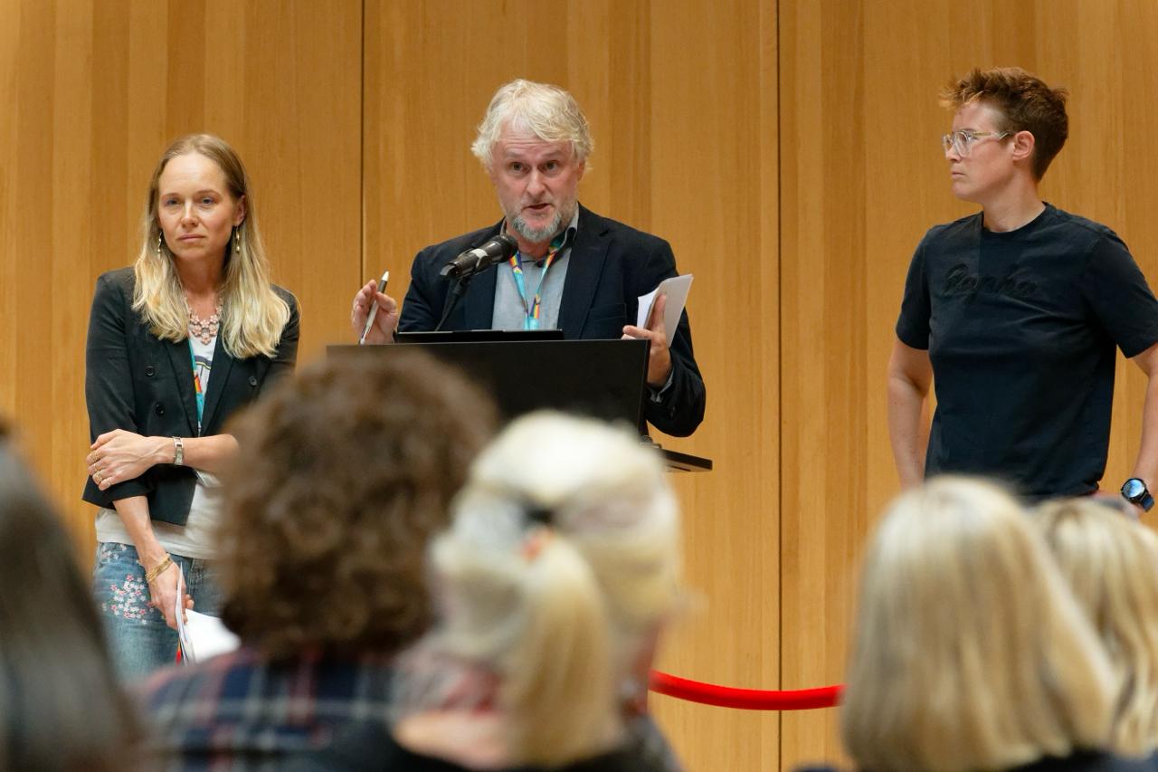
Significantly, the Greenways appear to have cross-party, and cross-council, backing. At the launch event yesterday, councillors from city and county, Labour, LibDem and Green, all spoke in support. Labour’s Anna Railton called it “a fantastic piece of work”, while the LibDems’ Gareth Epps described it as “a bold and exciting vision”.
Building traffic-free cycle routes in semi-rural areas is politically easier: no risk of angry residents setting bollards alight, or bus companies protesting against stolen road space. Done right, they could enable the housing that Government targets mandate – without the road construction that local voters fiercely oppose.
Could this be Oxford’s best chance of avoiding gridlock? The councils and university have set out lines on a map: the next challenge is to turn them into lines in a budget.
Further reading
- Greenways project page (Oxfordshire County Council) with full maps and report
- Cambridge Greenways