
The Oxford roads where most traffic is speeding
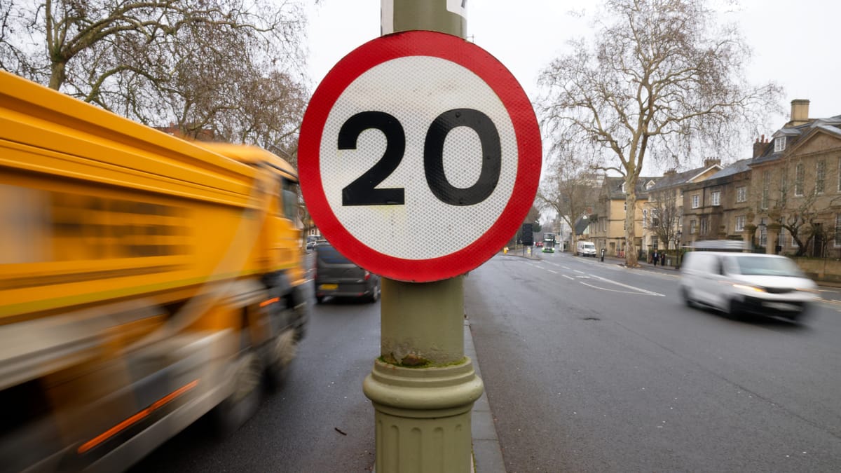
Roads outside schools, residential streets, and city centre arteries are among the ten worst roads for speeding in Oxford, according to new data.
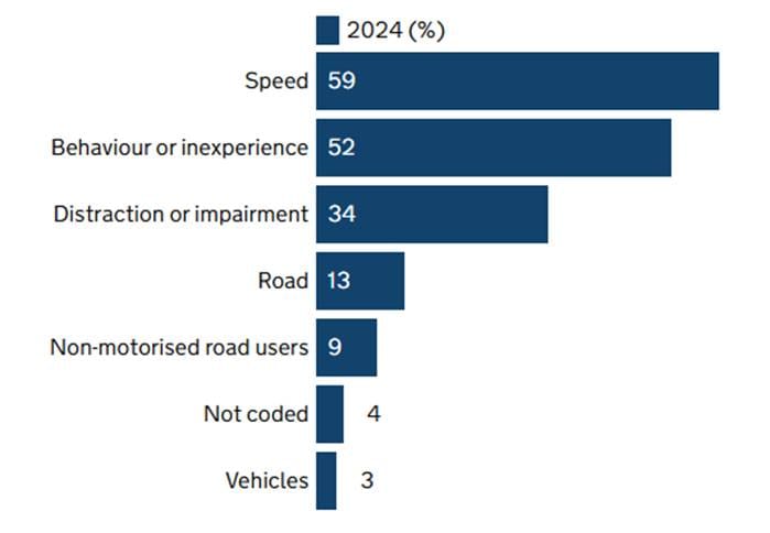
Speed is the single biggest factor in road deaths, cited as a factor in 950 (59%) of Britain’s fatal collisions in 2024.
Researchers at the University of Leeds, Healthy and Sustainable Places Data Service have now used a month of data from Compass IoT to plot where HGV and LGV drivers (lorries and vans) were exceeding speed limits in UK cities. We looked at the data from our own city of Oxford.
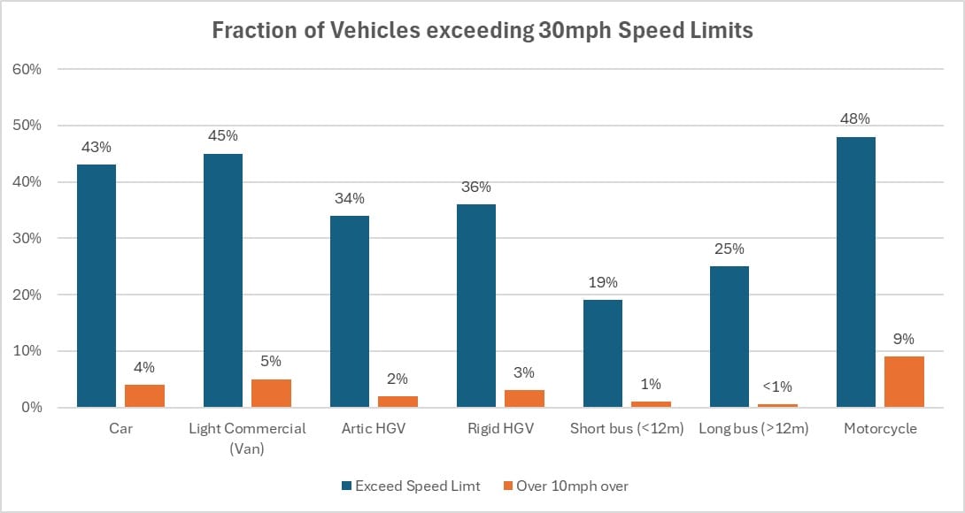
The data is from October 2023 and collected from telematics built in to the vehicles, but aggregated in an anonymised process to be non-identifiable. While the source means this data is purely from HGVs and LGVs, that is not because they are a particular speeding problem: van drivers speed slightly more than car drivers, but motorcyclists as a group speed most often. HGV drivers speed less often, though more than bus drivers. Still, if goods vehicle drivers are breaking the speed limit, it is a pretty good indication that other drivers will be too.
We’ve looked at which of Oxford’s roads have the highest fraction of goods vehicles speeding, and cross-referenced them against the record of collisions that have caused human casualties. Although we don’t have access to the ‘Road Safety Factor’ analysis for each, which would give some indication of whether speed or ‘driver/rider exceeding the speed limit’ were assigned by the police as a factor in the collision, speed is a factor in 59% of the worst (i.e. fatal) collisions. Whatever the direct cause, travelling faster gives less time to respond and makes collisions worse.
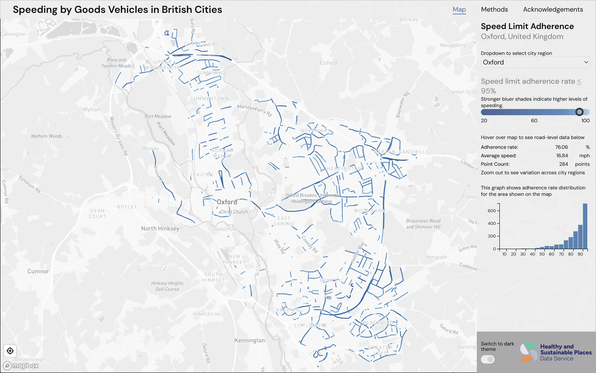
Surprisingly, two of the worst places for speeding are in the city centre – with under half of goods vehicles sticking to the speed limit.
St Giles has over 50% of goods vehicles breaking the limit at its north end (heading northbound). 40% of southbound vehicles here are also breaking the limit, and for many that extends most of the way to Beaumont Street. It’s a high casualty zone, particularly where northbound traffic heading for Banbury Road crosses southbound traffic from Woodstock Road (16 casualties in this small crossover alone, and another 22 further south in the 10 years from 2015 to 2024).
Parks Road, nearby, shows traffic speeding north past the park towards the junction with Banbury Road. Casualty numbers are lower here, but in 2016 a 35-year-old man drove into a tree at 5am one May morning, killing himself and seriously injuring his passenger.
Other speeding locations across Oxford include (working anti-clockwise):
- Godstow Road, just off the Wolvercote Roundabout in both directions. Several crashes have been recorded at the junction with Mere Road.
- Elsfield Road, entering Marston from the direction of the Ring Road, also has many speeding goods vehicles but fortunately no recent crashes.
- Old Marston Road southbound (on the section that is actually one of our many ‘Oxford Roads’) has a very low adherence to speed limits – perhaps exacerbated by the strange road design, a residential dual carriageway. This section has not seen many crashes: those seem to happen at the shops, or at the junction with Marston Road.
- London Road (A40), heading out of town just east of Green Road (Headington) roundabout, is one of the worst for speeders: under 10% stick to the 30mph limit as it passes Endeavour Academy. Adherence is under 50% for the whole stretch from the roundabout to the Park & Ride junction, where there is a cluster of road casualties – 8 outbound, 7 inbound in the last 10 years.
- Warneford Lane, where only 37% of goods traffic sticks to the speed limit, is also poor. Warneford Lane has seen 8 casualties in 10 years (plus more at the junctions at each end), but none since wand-protected cycle lanes were introduced in 2022. Nearby Morrell Avenue only just misses the cut, with 47% of goods drivers breaking the limit.
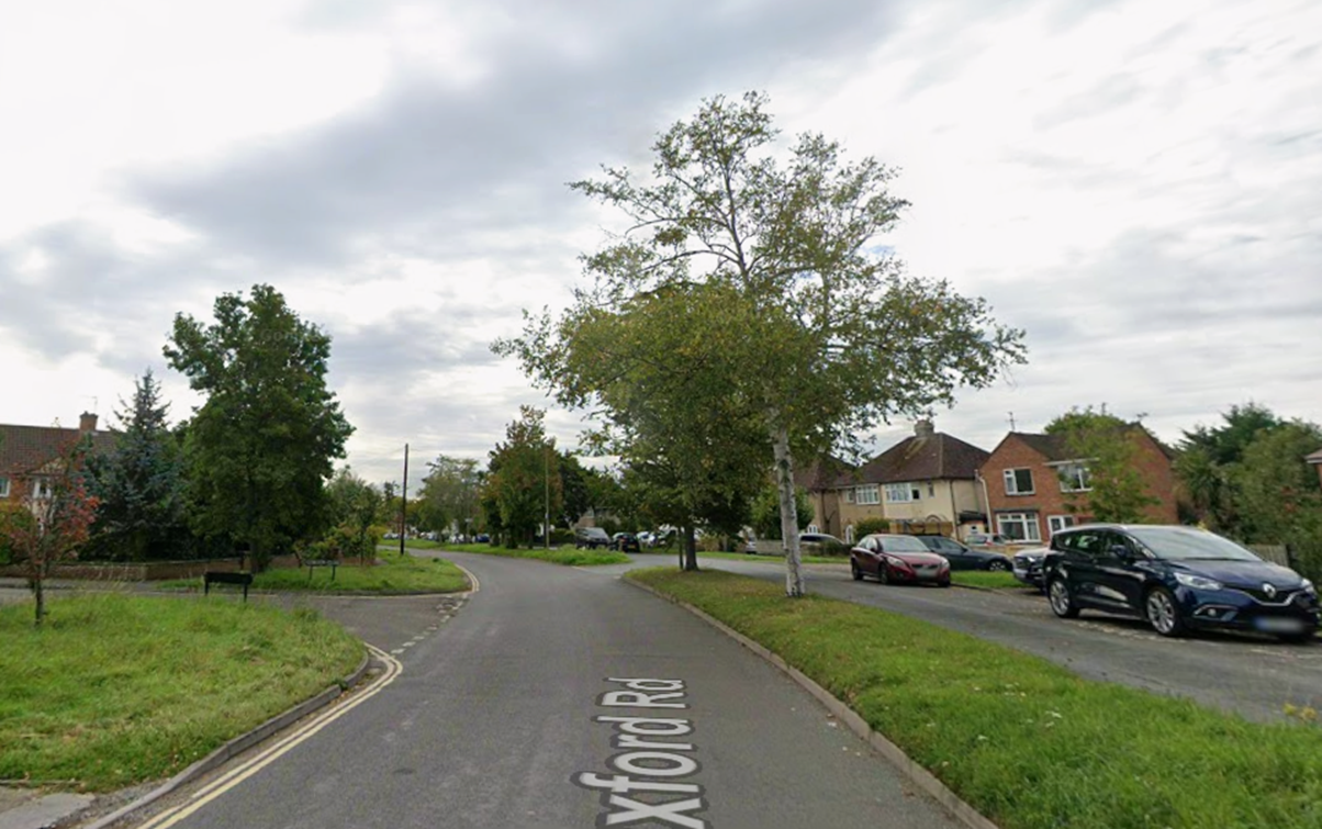
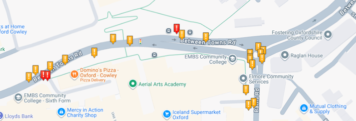
- Between Towns Road, eastbound either side of Barns Road, breaks the limit too. Are delivery drivers particularly sprightly after dropping their loads at Templars Square? Whatever the cause, Between Towns Road and the junction with Barns Road are two more casualty hotspots.
- Sandy Lane West in Littlemore has been a notorious rat run for years. Three children at the primary school there were injured by a car driver in 2022. Nudiario Fernandessam was later sentenced to a suspended prison sentence and disqualified for three years for dangerous driving. Traffic calming and a new crossing were installed in early 2025 as part of the County Council’s Vision Zero programme.
- Ashhurst Way is a wide straight residential road across Rose Hill. Locals will recognise the problems with this road. Despite its 20mph speed limits, there have been 7 casualties in 10 years on the road, plus 9 at the junction – and we don’t know how many ‘damage-only’ shunts, which are not recorded in the police data.
The data gives a clear steer as to where to prioritise enforcement, and locations where School Streets and similar schemes could make a real difference. There is an opportunity, too, to rethink road design at locations like the wide tarmac expanses of St Giles and the dual carriageway-like Old Marston Road.
Oxfordshire County Council’s Vision Zero programme attempts to identify these ‘hotspots’ in its ambition to eliminate deaths and serious injuries on the county’s roads. But about 90% of collisions have driver error as a contributory factor. It is a sobering reminder that, while the public debate obsesses about potholes and the (largely) monetary damage they can cause to tyres and cars, our streets are still lethal places for too many vulnerable road users.